
Ever wondered what it feels like to be in four places simultaneously?
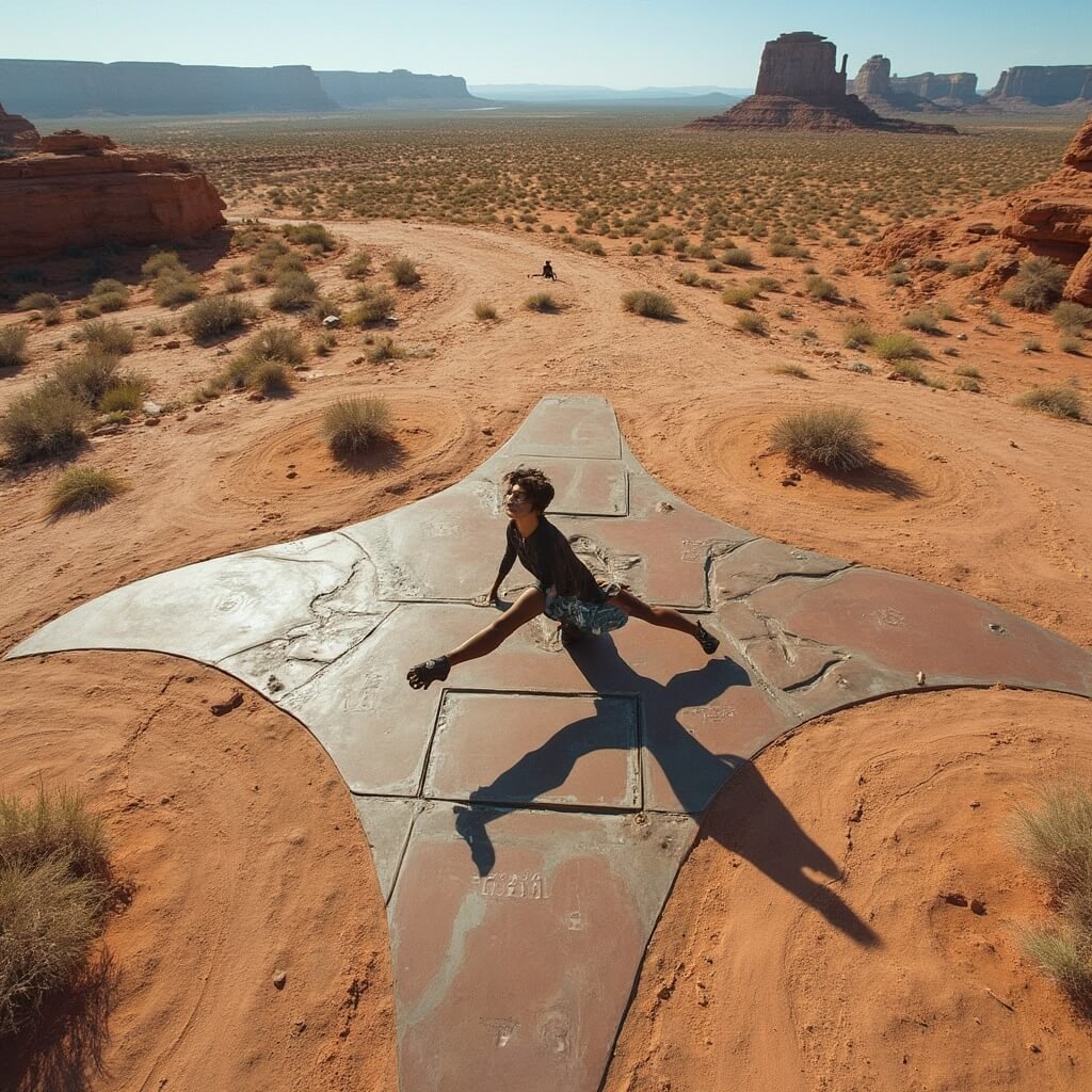
The Four Corners Monument is the ONLY spot in the United States where you can literally straddle four state lines at the same time. Picture this: one foot in Arizona, another in Utah, your right hand in Colorado, and left hand in New Mexico. Wild, right?

Where Geography Gets Weird: What Makes Four Corners So Special
Contents
- Where Geography Gets Weird: What Makes Four Corners So Special
- More Than Just Lines on a Map
- Climate That Challenges Survival
- The Legal Labyrinth: How Four Lines Create a Landmark
- Surveying the Impossible
- Cultural Crossroads: More Than Just Borders
- A Day in the Life of Four Corners
- The Visitor’s Ultimate Challenge
- The Climate That Defines the Experience
- The Ultimate Geographical Bucket List Item
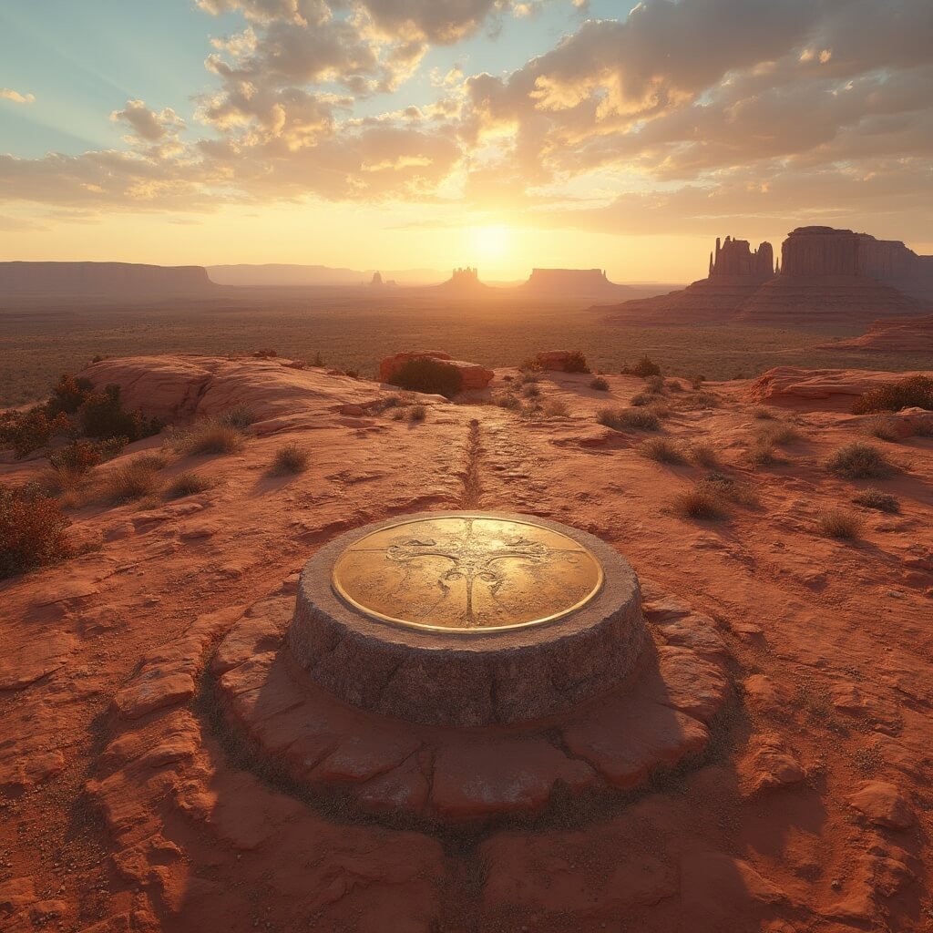
This isn’t just another roadside attraction. It’s a precise granite disk marking the exact point where Arizona, Colorado, New Mexico, and Utah kiss corners. Imagine a bronze marker embedded in stone, telling a story of political boundaries and territorial compromise.
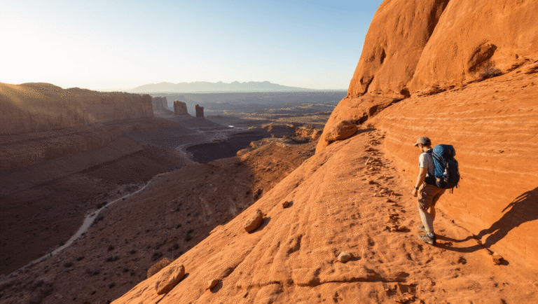
I remember my first visit. The sun was beating down, and the landscape looked like something straight out of a western movie. Dusty, remote, but weirdly magical.
The Unexpected History Behind Four Borders
The story starts way back in 1850. The Compromise of 1850 created New Mexico and Utah Territories, essentially drawing lines in the sand – literally. Civil War tensions played a massive role in defining these boundaries, with Congress strategically forming territories to prevent slavery’s spread.
Key historical moments:
- 1868: First government surveyors began mapping boundaries
- 1878: Rollin J. Reeves discovered the original sandstone marker
- 1912: A simple cement pad marked the spot
- 1992: Granite marker with copper disc established
- 2010: Official state seals and intersecting lines added
More Than Just Lines on a Map
This isn’t just a geographical curiosity. It’s a cultural crossroads.
The monument sits on land shared by two Native American nations:
- Navajo Nation
- Ute Mountain Ute Tribe
Local artisans sell souvenirs, creating a vibrant marketplace that transforms a remote marker into a living, breathing tourist destination.
The Ultimate Photo Op
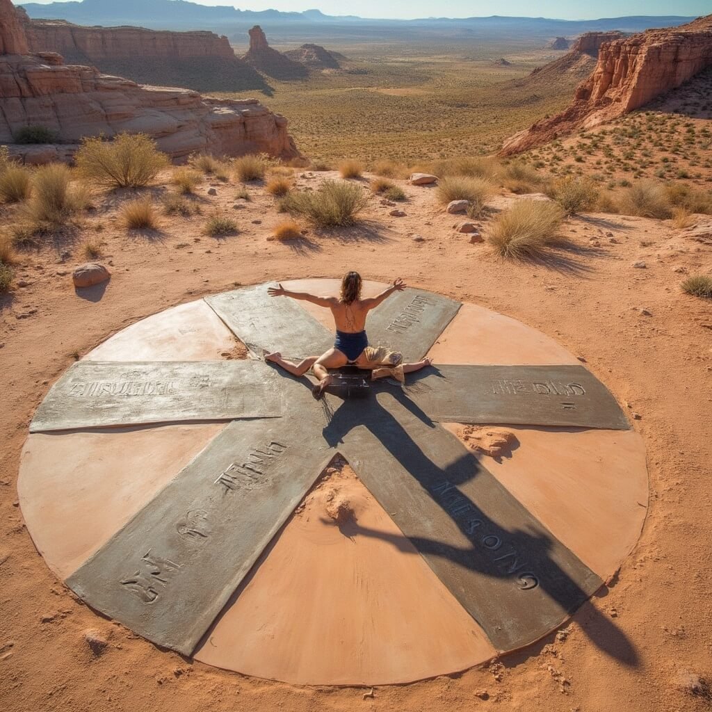
Visitors travel hundreds of miles for one reason: to play human pretzel. Imagine contorting yourself to touch all four states simultaneously. It’s like a geographical version of Twister.
Pro tip: Cash is king here. No fancy card payments. And get there early to avoid crowds.
Climate That Challenges Survival
This isn’t a gentle landscape. We’re talking extreme temperatures:
- Record high: 105°F
- Record low: −18°F
The climate? Cold semi-arid. Winters are sunny but freezing. Summers? Brutally hot and bone-dry.
Why This Matters More Than You Think
This monument represents more than state lines. It’s a testament to political negotiation, territorial expansion, and the complex history of the American Southwest.
Each state seal tells a story of when they joined the Union:
- Colorado: 1876
- Utah: 1896
- Arizona: 1912
- New Mexico: 1912
Want to challenge your understanding of physical space? Stand here. Suddenly, being in one place becomes wonderfully impossible.
The granite marker whispers an inscription: “Here meet in freedom under God four states.”
Sounds dramatic? Wait until you’re actually standing there.
My next move? Exploring the intricate legal boundaries that make this spot not just a curiosity, but a profound geographical landmark.
Looking for related travel inspiration? Check out our Spring & Easter Decor ideas or get festive with Easter Decor inspiration.
👇Find The Cheapest Flights To Anywhere Here👇
The Legal Labyrinth: How Four Lines Create a Landmark
Think borders are just lines on a map? Think again.
These four state boundaries represent decades of complex legal negotiations. Each line tells a story of political compromise, territorial ambition, and geographical precision.
Surveying the Impossible
Government surveyors in the late 19th century were basically geographic detectives.
Their tools? Astronomical measurements, precise compasses, and incredible patience. Imagine spending months in brutal southwestern terrain, measuring land inch by inch.
Rollin J. Reeves, one of these unsung heroes, literally discovered the original marker in 1878. His work transformed abstract political agreements into concrete geographical reality.
The Mathematical Magic of Boundaries
Here’s something mind-blowing: These boundaries weren’t random.
They were meticulously calculated using:
- 37th parallel north as primary reference
- Astronomical observations
- Advanced (for the time) surveying techniques
Each degree, each minute, each second matters when you’re defining state lines.
Cultural Crossroads: More Than Just Borders
The Four Corners Monument isn’t just a geographical curiosity. It’s a living cultural intersection.
Native American tribes – specifically the Navajo Nation and Ute Mountain Ute Tribe – don’t just live near this monument. They’re integral to its existence and management.
A Day in the Life of Four Corners
Want a snapshot of this unique place? Picture this:
- Local artisans selling handmade crafts
- Tourists twisting themselves into impossible poses
- The harsh southwestern sun beating down
- A quiet testament to human geographical imagination
The Visitor’s Ultimate Challenge
Standing in four states simultaneously isn’t just a trick. It’s a philosophical experience.
Where else can you simultaneously be in multiple jurisdictions, multiple geographic spaces, with a single body movement?
Practical Pro Tips for Your Four Corners Adventure
Preparing isn’t just recommended – it’s essential.
Visitor Survival Guide:
- Bring cash (no card payments)
- Arrive early to beat crowds
- Pack water (it gets HOT)
- Expect a small admission fee
- Plan your epic photo strategy
The Climate That Defines the Experience
This isn’t a gentle landscape. This is nature in its most uncompromising form.
Temperature extremes here aren’t just numbers. They’re a survival challenge:
- Summer highs: 105°F
- Winter lows: −18°F
- Annual precipitation: Barely 8 inches
The landscape whispers: “Only the adaptable survive.”
Beyond the Marker: A Symbol of Unity
Each state seal tells a story of inclusion, of becoming part of something larger.
Colorado (1876). Utah (1896). Arizona and New Mexico (1912).
These aren’t just dates. They’re chapters in an ongoing American narrative of expansion, compromise, and connection.
The Ultimate Geographical Bucket List Item
Standing at Four Corners isn’t just a tourist activity. It’s a transformative experience.
You’re not just visiting a location. You’re participating in a geographical performance art piece, challenging the very notion of “being in one place.”
As the monument’s inscription reads: “Here meet in freedom under God four states.”
Freedom. Connection. Possibility.
All contained in a single, magical point where four states kiss.
My recommendation? Make this your next adventure.
Stand in four states at once. Challenge your understanding of space, borders, and human possibility.
The Four Corners Monument awaits.
Looking to complete your seasonal travel inspiration? Check out these themed ideas:
👇Ready To Book Your Trip?👇
This post may contain affiliate links. Please see my disclosure policy for details.